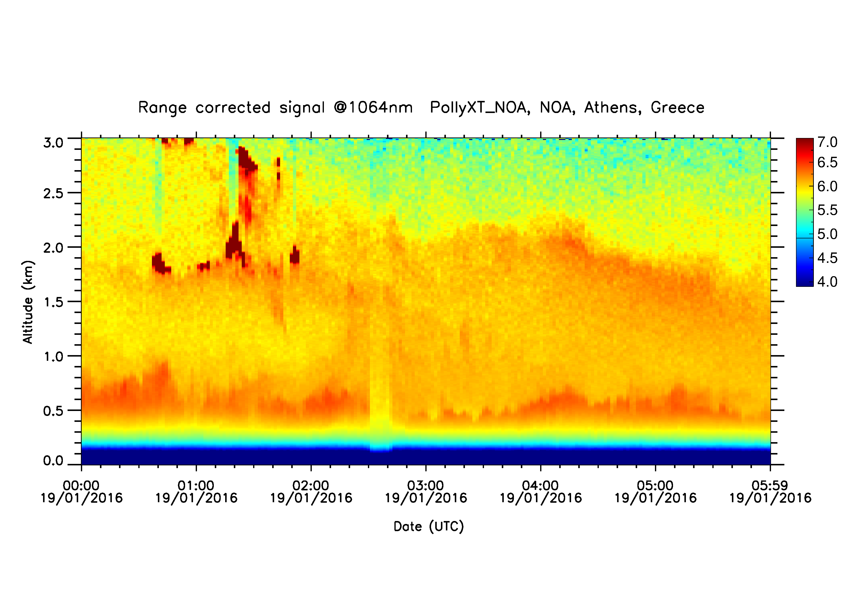
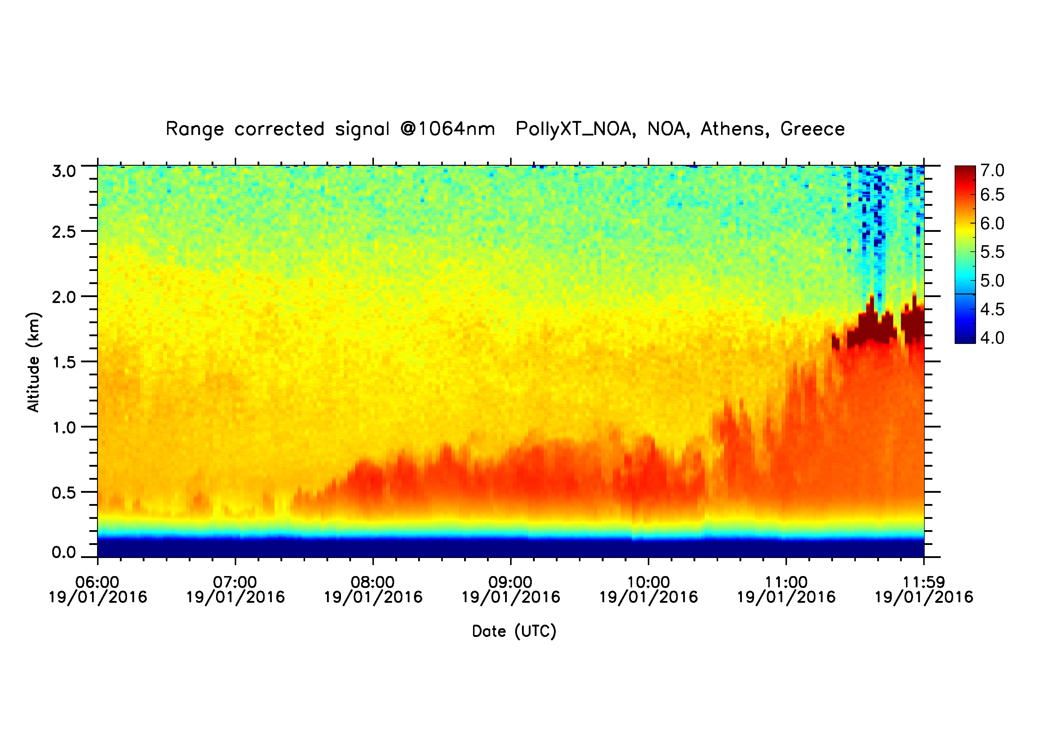
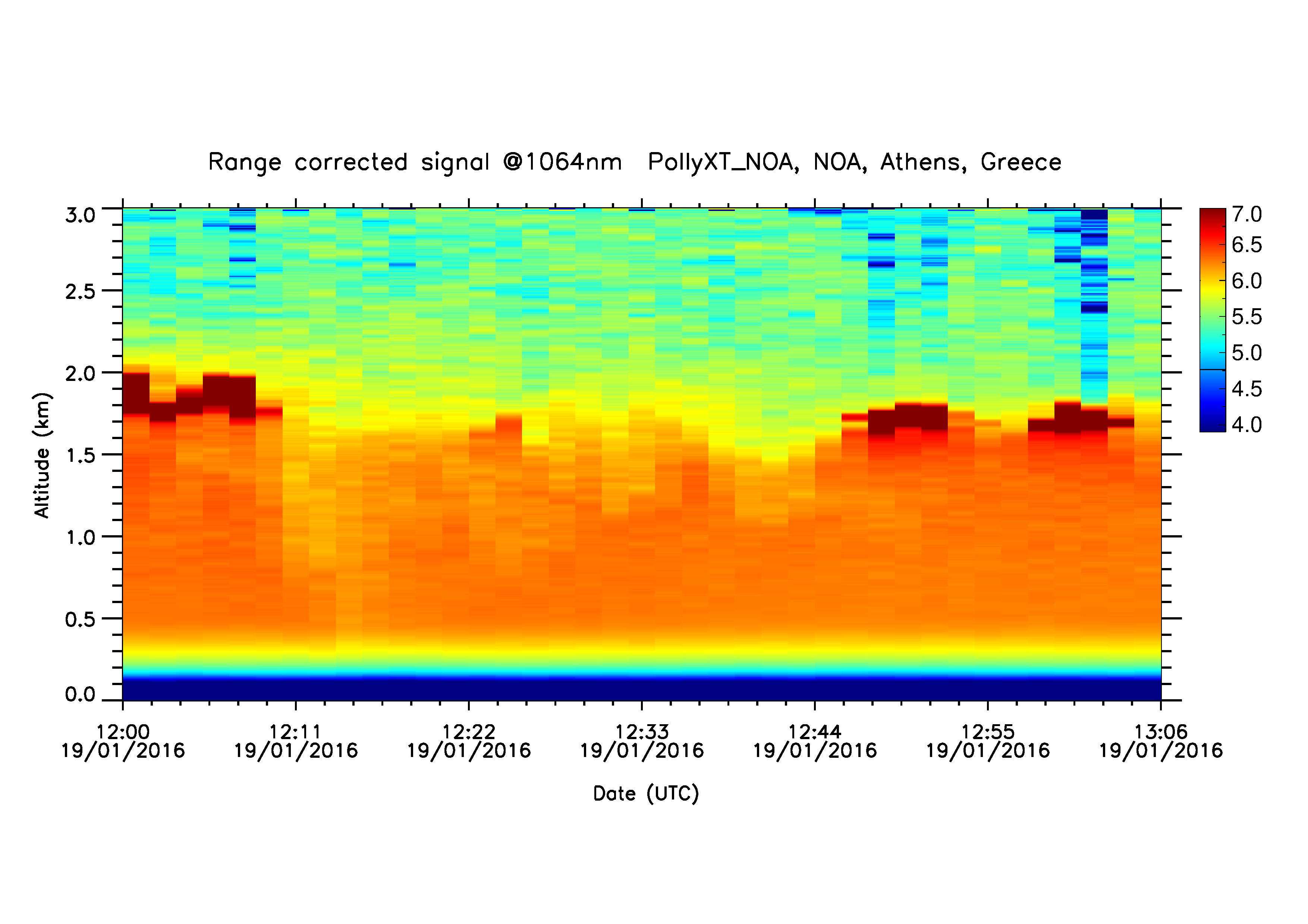
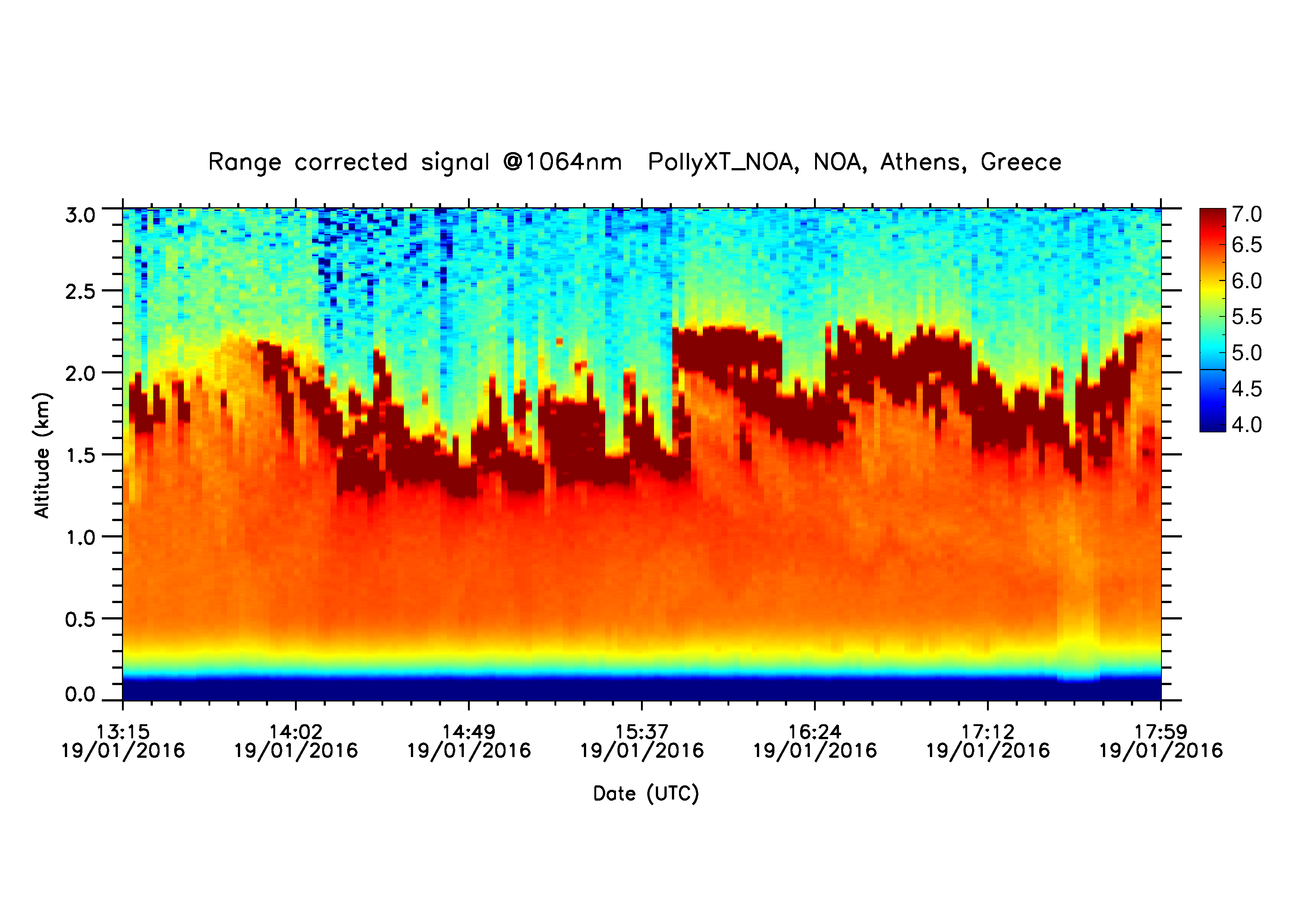
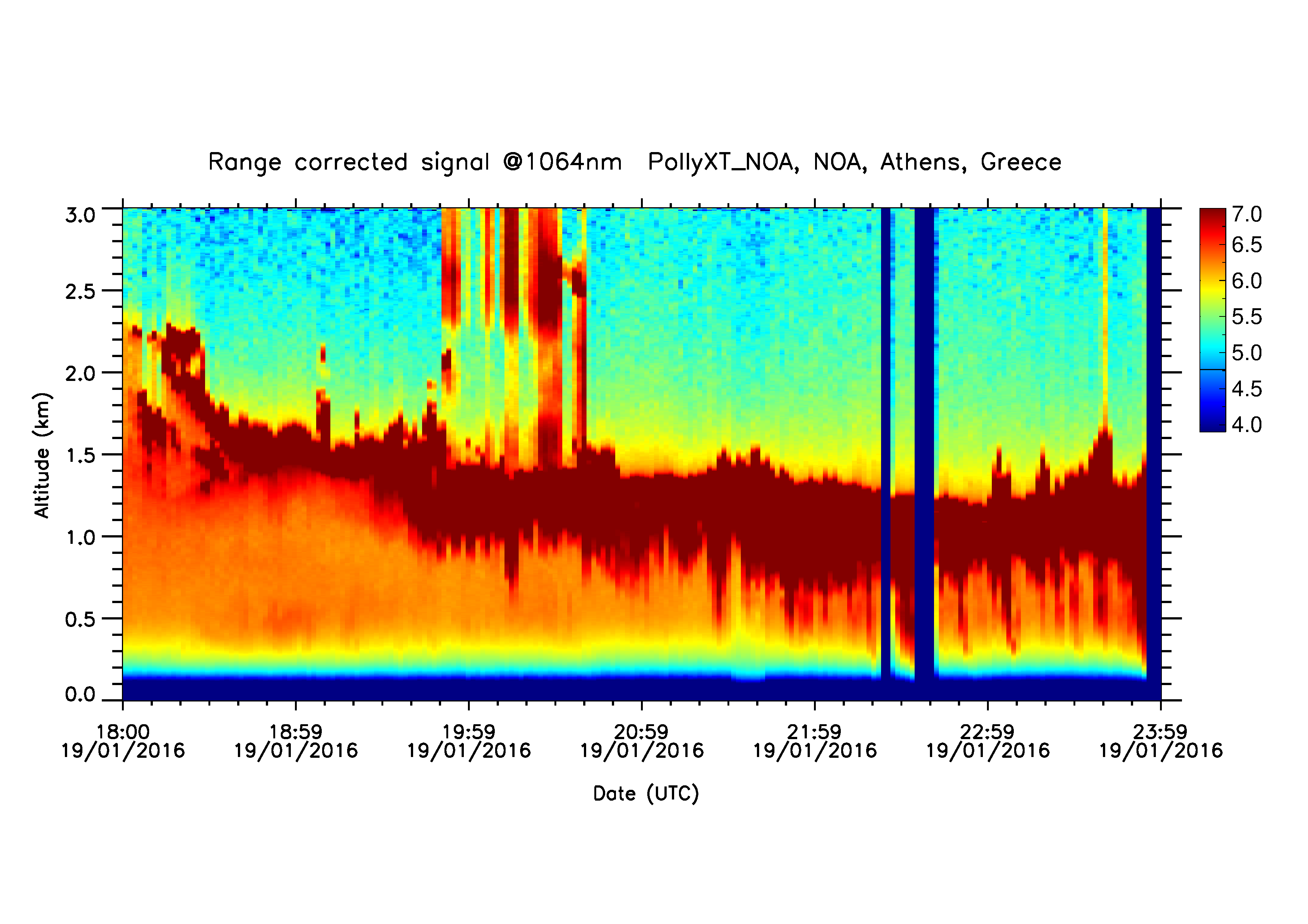
PollyXT Overview
Automatically uploaded on 2016-01-20 16:20:05.
| Start time | Jan. 19, 2016, midnight |
| Stop time | Jan. 20, 2016, midnight |
| Duration | 1 day |
| Instrument | PollyXT Raman lidar |
Related graphs
Logs & Measurements
PollyXT Raman lidar logs
- Beam adjustment (Jan 20th, 2016)
- Beam adjustment - NARLA's NDFs adjustment (Jan 19th, 2016)
Parallel measurements
- PollyXT (Jan 20th, 2016)
- PollyXT (Jan 20th, 2016)
- PollyXT (Jan 20th, 2016)
- PollyXT (Jan 20th, 2016)
- FLEXPART Retroplumes (Jan 20th, 2016)
- NMME-DREAM (Jan 20th, 2016)
- PollyXT Overview (Jan 20th, 2016)
- FLEXPART smoke forecast (Jan 20th, 2016)
- PollyXT (Jan 19th, 2016)
- PollyXT (Jan 19th, 2016)
- PollyXT (Jan 19th, 2016)
- EOLE (Jan 19th, 2016)
- PollyXT (Jan 19th, 2016)
- PollyXT (Jan 19th, 2016)
- FLEXPART smoke forecast (Jan 19th, 2016)
- FLEXPART Retroplumes (Jan 19th, 2016)
- NMME-DREAM (Jan 19th, 2016)
- CIMEL (Jan 19th, 2016)
- PollyXT (Jan 18th, 2016)
- FLEXPART smoke forecast (Jan 18th, 2016)
- PollyXT Overview (Jan 18th, 2016)
- NMME-DREAM (Jan 18th, 2016)
- FLEXPART Retroplumes (Jan 18th, 2016)
