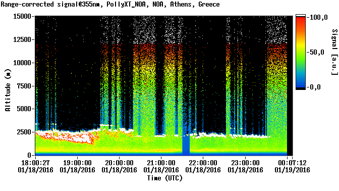
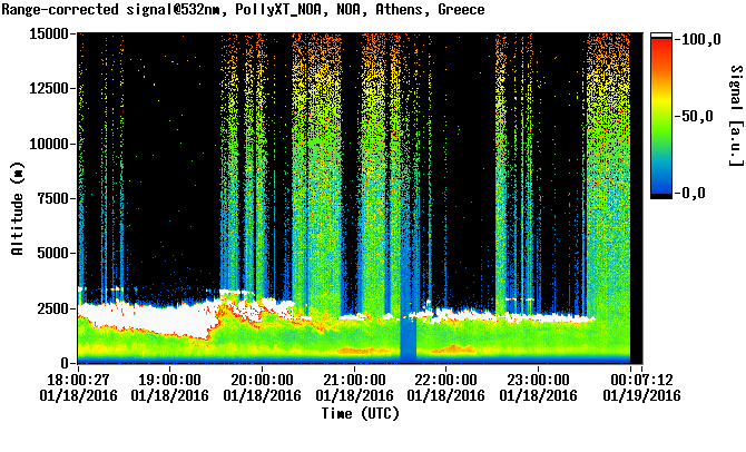
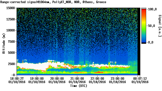
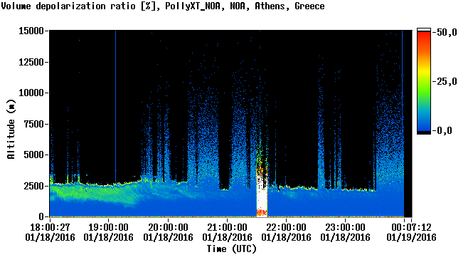
PollyXT
Automatically uploaded on 2016-01-20 12:50:12.
| Start time | Jan. 18, 2016, 6 p.m. |
| Stop time | Jan. 19, 2016, midnight |
| Duration | 6 hours |
| Instrument | PollyXT Raman lidar |
Related graphs
Logs & Measurements
PollyXT Raman lidar logs
- Beam adjustment - NARLA's NDFs adjustment (Jan 19th, 2016)
- Window cleaning - Heater & AC disabled - No network (Jan 18th, 2016)
Parallel measurements
- PollyXT (Jan 19th, 2016)
- PollyXT (Jan 19th, 2016)
- PollyXT (Jan 19th, 2016)
- EOLE (Jan 19th, 2016)
- PollyXT (Jan 19th, 2016)
- PollyXT (Jan 19th, 2016)
- CIMEL (Jan 19th, 2016)
- FLEXPART Retroplumes (Jan 19th, 2016)
- NMME-DREAM (Jan 19th, 2016)
- FLEXPART smoke forecast (Jan 19th, 2016)
- PollyXT Overview (Jan 19th, 2016)
- PollyXT (Jan 18th, 2016)
- PollyXT (Jan 18th, 2016)
- PollyXT (Jan 18th, 2016)
- PollyXT (Jan 18th, 2016)
- FLEXPART Retroplumes (Jan 18th, 2016)
- FLEXPART smoke forecast (Jan 18th, 2016)
- NMME-DREAM (Jan 18th, 2016)
- PollyXT Overview (Jan 18th, 2016)
- PollyXT (Jan 17th, 2016)
- FLEXPART smoke forecast (Jan 17th, 2016)
- NMME-DREAM (Jan 17th, 2016)
- PollyXT Overview (Jan 17th, 2016)
- FLEXPART Retroplumes (Jan 17th, 2016)
- CIMEL (Jan 17th, 2016)
